Fiery Shores of Bay of Fires
Category
Kayaking
Typical Duration
17-25 hours
Difficulty
Moderate
Nearby Experts
Photo Gallery
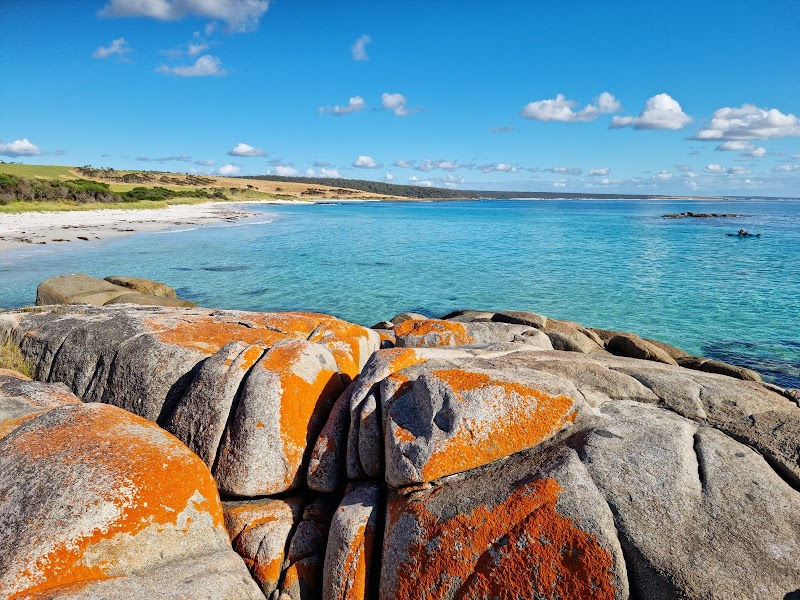
Fiery Shores of Bay of Fires - Bay of Fires
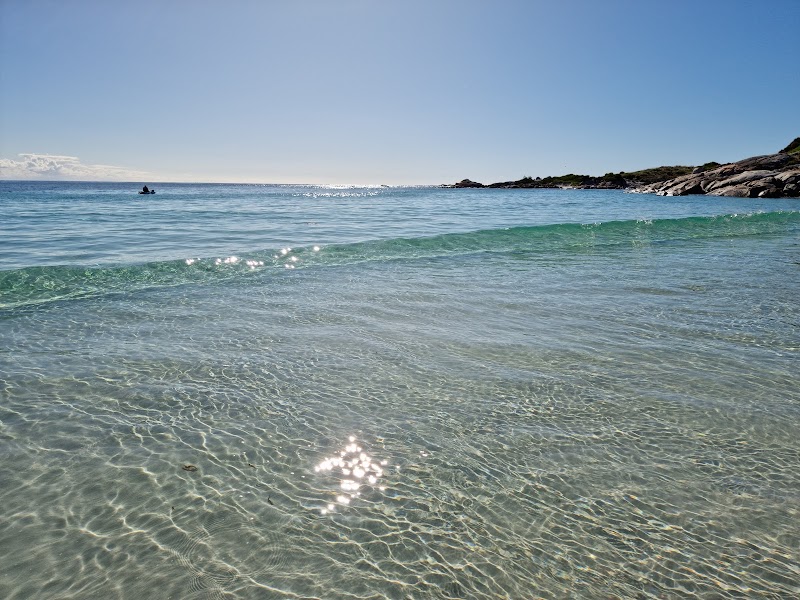
Fiery Shores of Bay of Fires - Bay of Fires
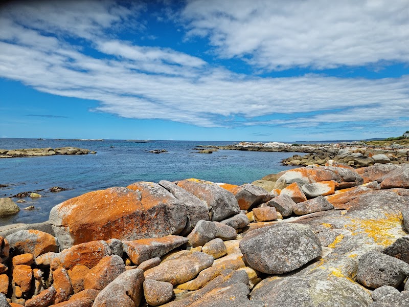
Fiery Shores of Bay of Fires - Bay of Fires
About This Landmark
Vibrant and breathtaking, the Bay of Fires in Tasmania is a natural wonder located on the northeastern coast. Known for its stunning beaches and distinctive orange-hued granite rocks, the Bay of Fires stretches over 50 kilometers from Binalong Bay to Eddystone Point. This beach is famed for its pristine white sands, crystal-clear waters, and the unique spectacle of lichen-covered boulders that lend the bay its fiery name. Discovered by Captain Tobias Furneaux in 1773, the bay was named after the numerous Aboriginal fires seen along the coast. Visitors are drawn to its tranquility and unspoiled beauty, making it a perfect escape into nature. The area is not only a photographer's paradise but also a haven for outdoor enthusiasts seeking adventure or solitude amidst stunning coastal landscapes.
Adventure Guide To Bay of Fires
1. Hiking Through Binalong Bay
- What makes it special: Located at the southern end of the Bay of Fires, Binalong Bay is the gateway to the scenic beauty of white sandy beaches and rocky headlands.
- Key features: Start from Skeleton Bay Reserve for breathtaking views. Trails vary from easy walks to more challenging hikes.
- Local Insights: Look out for native wildlife such as kangaroos and echidnas.
- Visitor Tips: Best to visit in spring for pleasant weather; bring a camera and comfortable walking shoes.
2. Kayaking Adventures
- What makes it special: Paddle along the clear waters to explore hidden coves and enjoy diverse marine life.
- Key features: Calm waters suitable for beginners, plenty of marine wildlife spotting.
- Local Insights: Local guides offer tours providing insights into the area's ecology.
- Visitor Tips: Best time to visit is early morning; bring sunscreen and a waterproof camera.
3. Beach Camping at Cosy Corner
- What makes it special: Camp near the beach for an immersive experience in nature.
- Key features: Designated camping spots with basic amenities, gorgeous sunsets.
- Local Insights: Campfires are allowed, providing a cozy atmosphere under the starry skies.
- Visitor Tips: Ideal to camp in summer; pack enough supplies as facilities are limited.
Driving Directions: From Hobart, take the Tasman Highway (A3) to St Helens, then follow signs to the Bay of Fires (approximately 4 hours).
Location
Fiery Shores of Bay of Fires in Bay of Fires
Coordinates: -41.1400, 148.3000
Ratings
Overall
Photography
Reviews
Featured Activities
Primary Activity
Kayaking
Also Great For
Essential Information
Nearby City
Protected Areas
Experience Level
Experience Needed: This natural landmark is recommended for those with some outdoor experience. Good for regular hikers.